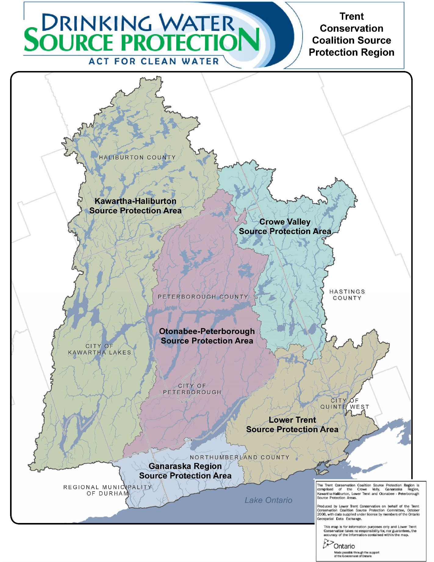
What is the Trent Conservation Coalition Source Protection Region?
The Clean Water Act sets out a framework for source protection planning on a watershed basis. A watershed is an area of land that is drained by a river and its tributaries into a body of water such as a lake or river. Water is shared as it flows across the boundaries of municipalities, cities and towns. The best way to protect water is on a watershed-basis. The Trent Conservation Coalition Source Protection Region includes both the Trent and Ganaraska watersheds.
Under the Act, Source Protection Areas were established based on the watershed boundaries of Ontario's 36 Conservation Authorities. The Crowe Valley, Ganaraska, Kawartha, Lower Trent and Otonabee Conservation Authorities have entered into a partnership for this region. These five Conservation Authorities, encompass a 14,500 square kilometre area stretching from Algonquin Park to Lake Ontario and the Bay of Quinte. Collectively they comprise The Trent Conservation Coalition Source Protection Region.